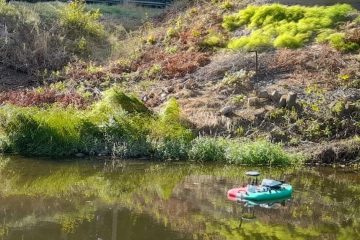
Supersite – Vantaanjoki River
Among the most heavily constructed and impacted watersheds in Finland
- Area 1680 km2, Length 99 km
- >1 000 000 people
- Reserve water resource for Helsinki
- Ecological status mostly <good
- Data collection and research in the watershed area has been done in collaboration with Vantaanjoen ja Helsingin seudun vesiensuojeluyhdistys , who have an active role in the environmental monitoring and management of the river.
Image: Aalto university
Pitkäkoski, online data
- FLIR A70 thermal camera
- RGB camera
- Multispectral camera
- Trios Opus spectrometer
- Trios Microflu v2 fluorometer
- YSI Exo2 multiparametersonde,
- S::CAN spectrometer
- 2 x Water level sensor
Myllymäki, online data
- Soil Scout – soils sensors (temperature, salinity, movement, moisture)
Ylikylä, online data
- Thermal camera, RasperryPi
- RGB cameras
Examples of measurements done during 2021-2023
- Water level, 3D flow characteristics
- Temperature of soil and water
- River bathymetry, point/multibeam
- Aerial photography: RGB, Thermal, Multispectral
- Landsurvey/topography (point clouds and GPS measurements)
- Sediment data
- Water samples (water quality: Ph, turbidity, DOC, TOC, iron, phosphorus, nitrogen,electric conductivity etc.)
- Measurements each season -> Change detection.
Contact information for collaborations, data and general inquiries:
Finnish Environment Institute: Anna-Kaisa Ronkanen (Anna-kaisa.ronkanen@syke.fi)
Aalto university: Eliisa Lotsari (eliisa.s.lotsari(at)aalto.fi)

